Published
The Fishermen’s Trail, Southwest Portugal - Day 1 - Porto Covo to Vila Nova de Milfontes
Fishermen’s Trail, South West Portugal
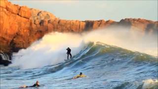
We were very excited for the first day of the walk, which is said to be spectacular with both beach and cliff top walking, with pretty wild flowers too. Our guide book said 5 hours, 20km to Vila Nova de Milfontes, the information boards in Porto Covo said 20km, 8 hours, a difficult walk, and don't go near the cliff edge. We had checked the route the day before, and as no small villages were passed, we had bought lunch the night before to take with us. We returned to cafe Cantarinha where we had had a small lunch the previous day, having our usual breakfast of coffee and toast (€6.00), leaving at 8am. We had spent some time the previous night finding the start of the walk, with no obvious signage (to us anyway). We were so pleased we had done this, enabling us to make a fast getaway, turning down Rua do Mar, then left at restaurant Miramar, down Rua dos Pescadores, to the fishing harbour, passing white, red and yellow stripes on a post. The path goes through the river (not sure what happens when the tide is in) and up a hill, passing some dwellings. We turned right by a sign saying 19.5km to Vila Nova de Milfontes along the Roto de Vicentina. The path runs parallel with the beach, with splendid views, following green, red and yellow signs. We passed Praia do Sissal beach (8.40am), and enjoyed walking along the sand.
We passed the fortified island of Ilha do Pessegueiro, which was occupied by the Carthaginians in the C3rd B.C., then subsequently used by the Romans as a fishing port. We went up a board walk to Restaurante a Ilha (shut) one hour/2.2 miles after leaving. Make time to look at the very impressive fort, built in 1588 in order to prevent attacks from English pirates. Continuing along the cliffs, then a beautiful beach, up a boardwalk to the car park at Malhao beach-with a locked toilet. 3 hours. 6 miles. 500 feet elevation. The views from the boardwalks are sublime back north to Sines and Porto Covo, and south to our destination. Going south again, the path veered away from the ocean, and we got lost through a series of sand dunes, which seemed to have numerous paths available. We continued using the radio towers and buildings in the distance as a marker, arriving at Ponta das Barcas with a bar and restaurant at 1.15pm. We stopped to have a drink and a snack in the shady bar (not the cheapest). It was a Sunday lunch and the many people eating there, looked a lot smarter than us!! Leaving at 2pm-the day had really heated up now, we went 200m down the road, then took the arrow right. The path splits and we followed the middle one with blue and green signs towards the town. We arrived at the stunning river estuary and castle 35 minutes later, unfortunately there was no shade to sit in. We walked up the road and checked into Sol da Vila. It was great value for money, with beautiful accommodation, an outdoor courtyard, a roof terrace and a very friendly receptionist. Later we ate dinner at 100 Espinhas, great value for money, nice food and good service, recommended by our hotel receptionist, opening at 7pm. We had really enjoyed our first day of this walk. It had exceeded all expectations.
The views, sea, and beaches were exceptional. We have rarely had such a beautiful coastal walk.
Distance 12.2 Miles (19.7km)
Duration of Walk 6.5 Hours
Average Pace 33 Min/Mile
Steps 39031
Elevation Gained 645 feet (197m)
Websites used
https://www.tripadvisor.co.uk/Restaurant_Review-g784072-d3265520-Reviews-Porto_De_Barcas-Vila_Nova_de_Milfontes_Beja_District_Alentejo.html Lunch
booking.com Sol da Vila Hotel
https://www.facebook.com/people/Restaurante-100-Espinhas/100057374982360/ Dinner
Fishermen’s Trail, South West Portugal
We were very excited for the first day of the walk, which is said to be spectacular with both beach and cliff top walking, with pretty wild flowers too. Our guide book said 5 hours, 20km to Vila Nova de Milfontes, the information boards in Porto Covo said 20km, 8 hours, a difficult walk, and don't go near the cliff edge. We had checked the route the day before, and as no small villages were passed, we had bought lunch the night before to take with us. We returned to cafe Cantarinha where we had had a small lunch the previous day, having our usual breakfast of coffee and toast (€6.00), leaving at 8am. We had spent some time the previous night finding the start of the walk, with no obvious signage (to us anyway). We were so pleased we had done this, enabling us to make a fast getaway, turning down Rua do Mar, then left at restaurant Miramar, down Rua dos Pescadores, to the fishing harbour, passing white, red and yellow stripes on a post. The path goes through the river (not sure what happens when the tide is in) and up a hill, passing some dwellings. We turned right by a sign saying 19.5km to Vila Nova de Milfontes along the Roto de Vicentina. The path runs parallel with the beach, with splendid views, following green, red and yellow signs. We passed Praia do Sissal beach (8.40am), and enjoyed walking along the sand.
We passed the fortified island of Ilha do Pessegueiro, which was occupied by the Carthaginians in the C3rd B.C., then subsequently used by the Romans as a fishing port. We went up a board walk to Restaurante a Ilha (shut) one hour/2.2 miles after leaving. Make time to look at the very impressive fort, built in 1588 in order to prevent attacks from English pirates. Continuing along the cliffs, then a beautiful beach, up a boardwalk to the car park at Malhao beach-with a locked toilet. 3 hours. 6 miles. 500 feet elevation. The views from the boardwalks are sublime back north to Sines and Porto Covo, and south to our destination. Going south again, the path veered away from the ocean, and we got lost through a series of sand dunes, which seemed to have numerous paths available. We continued using the radio towers and buildings in the distance as a marker, arriving at Ponta das Barcas with a bar and restaurant at 1.15pm. We stopped to have a drink and a snack in the shady bar (not the cheapest). It was a Sunday lunch and the many people eating there, looked a lot smarter than us!! Leaving at 2pm-the day had really heated up now, we went 200m down the road, then took the arrow right. The path splits and we followed the middle one with blue and green signs towards the town. We arrived at the stunning river estuary and castle 35 minutes later, unfortunately there was no shade to sit in. We walked up the road and checked into Sol da Vila. It was great value for money, with beautiful accommodation, an outdoor courtyard, a roof terrace and a very friendly receptionist. Later we ate dinner at 100 Espinhas, great value for money, nice food and good service, recommended by our hotel receptionist, opening at 7pm. We had really enjoyed our first day of this walk. It had exceeded all expectations.
The views, sea, and beaches were exceptional. We have rarely had such a beautiful coastal walk.
Distance 12.2 Miles (19.7km)
Duration of Walk 6.5 Hours
Average Pace 33 Min/Mile
Steps 39031
Elevation Gained 645 feet (197m)
Websites used
https://www.tripadvisor.co.uk/Restaurant_Review-g784072-d3265520-Reviews-Porto_De_Barcas-Vila_Nova_de_Milfontes_Beja_District_Alentejo.html Lunch
booking.com Sol da Vila Hotel
https://www.facebook.com/people/Restaurante-100-Espinhas/100057374982360/ Dinner
- Category
- PORTUGAL
Be the first to comment
Up Next
-
05:56

The Fishermen’s Trail, Southwest Portugal - Day 2 - Vila Nova de Milfontes to Almograve
-
30:09
The Fishermen's Trail: Backpacking Adventure Across Southern Portugal
-
06:16
The Fishermen’s Trail, Southwest Portugal - Day 6 - Aljezur to Arrifana
-
06:20
Fishermen’s Trail - Day 1 - The Algarve section , Southern Portugal - Sagres to Salema
-
11:21
Portugal 2022: da Villa Nova de Milfontes a Lagos (Algarve)
-
00:57
Vila Nova de Gaia, Porto, Portugal. Restaurante com vista para o Rio Douro e Ponte Luís I.
-
37:07
???? TET Portugal 2022 Trail - Día 10 - Sección 2 ???? Rutas en Moto Trail - Trans Euro Trail off ro
-
06:13
The Fishermen’s Trail, Southwest Portugal - Day 5 - Odeceixe to Aljezur
-
02:24
Villa Eira - Best Hotel in the City? | Vila Nova de Milfontes, Portugal????
-
05:56
The Fishermen’s Trail, Southwest Portugal - Day 3 - Almograve to Zamujeira do Mare
-
03:38

Visita A Cidade De Faro (Algarve, Portugal) RTP
-
03:47
Filme Algarve Clube Surf Faro Vs Komunity IPDJ 2014
-
04:14

Faro, Algarve, Portugal
-
03:23

Faro - Algarve (Portugal)
-
14:56

Praia De Faro, Algarve, Portugal
-
04:01

Visita A Faro (Algarve, Portugal)
-
03:06
FARO | ALGARVE - Ilha De Faro VS Ria Formosa Portugal By Drone
-
06:15

Portugal Algarve Découverte De La Vieille Ville De Faro Ou Nichent Les Cigognes
-
03:49
Hotel Faro - Faro - Algarve - Portugal
-
05:50
Relaxing Time - Ilha Deserta Em Faro (Algarve, Portugal)
